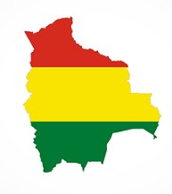
Bolivia is a landlocked country in South America that is bordered Brazil, Paraguay, Argentina, Chile and Peru.
The administrative capital (and seat of government) is La Paz. The constitutional capital is Sucre (the seat of the judiciary). While the largest city and main industrial center is Santa Cruz de la Sierra.
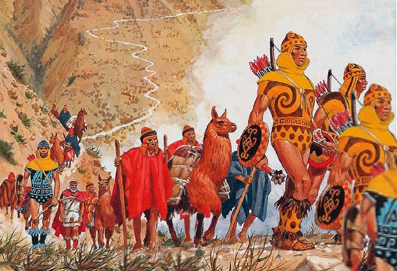
Before Spanish colonisation, the area that is now Bolivia was part of the Inca Empire. But in the 16th century, Spanish conquistadors took control of the region and found it to be rich in silver deposits. Spain built its empire, in large part ,upon the silver that was extracted from Bolivia’s mines.
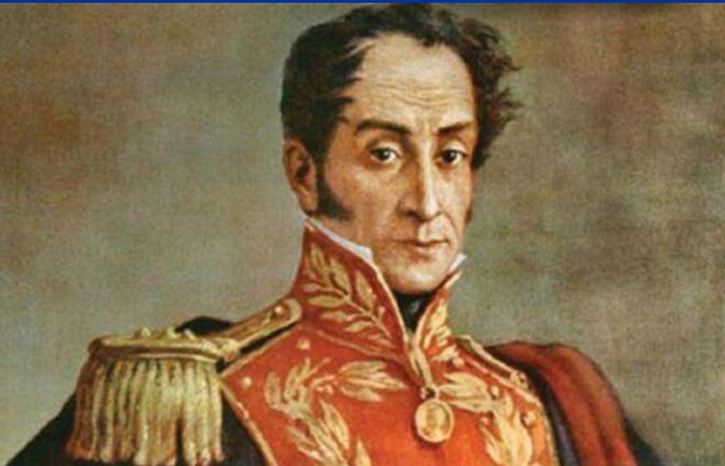
Bolivia was named after Simón Bolivar (officially José Antonio de la Santísima Trinidad Bolívar Palacios Ponte y Blanco) who was a Venezuelan leader that led the majority of South America (Colombia, Venezuela, Ecuador, Peru, Panama, and Bolivia) to independence from the Spanish Empire. Bolivia gained its independence in 1825.
Lake Titicaca is about the only thing I had heard about from Bolivia and we didn’t get near it. It is the largest lake in South America and sits high in the Andes mountains on the border of Bolivia and Peru. The western part of the lake lies within Peru while the eastern side is located in Bolivia, near La Paz.


Five major river systems feed into Lake Titicaca (Ramis, Coata, Ilave, Huancané, and Suchez) and more than 20 other smaller streams also empty into Titicaca. There are 41 islands on the lake, some of which are densely populated.
Most importantly, Lake Titicaca is the legendary birthplace of the Inca civilization, and is also believed to hold precious Inca treasure.
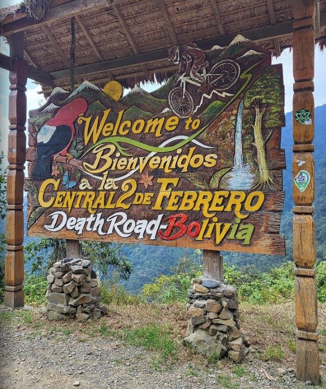
The other thing that I had seen about Bolivia was about the Yungas Road. This is more commonly known as death road. I had seen documentaries of cars, trucks and buses trying to navigate (and pass each other) on this stretch of road, often in pouring rain, with landslides taking place underneath vehicle tyres. All of this on the side of a cliff with inches to spare.


The steep slopes, lack of guardrails, narrow width of the road (3 meters in some places), weather conditions (rain and fog would reduce visibility), muddy terrain and loose stones made it the most dangerous road on the planet. It was infamous for its dangerous conditions and deaths. Before an alternate route was built it averaged 209 accidents with 96 deaths per year.


In July 1983, a bus fell from the Yungas Road into a canyon, killing more than one hundred passengers (I am still trying to work out how you get 100 people in a bus) in one of the worst road accidents in Bolivia. Until the mid-1990s, 2-300 drivers fell off to the cliff each year.
When it stopped being used as a vehicle road (due to the danger) it has now become a 60 km downhill mountain biking route between La Paz and the Yungas region.
Even as a cycle path, at least 18 cyclists have died on the road since 1998.


Santa Cruz de la Sierra
This mouthful translates as the Holy Cross of the Mountain Range and is the largest city in Bolivia, with a population of around 2.4 million.
The city was first founded in 1561 by Spanish explorers and remained fairly small until the mid-20th century.
But now it is the most important business center producing nearly 35% of Bolivia’s GDP, and receiving over 40% of all foreign direct investment in the country.
Our arrival here was great. We checked in to a local hostel that was right in the middle of things (restaurants, clubs and bars) and a relatively short walk (1.5 km) to the heart of town. Having arrived fairly late (and not that hungry) we settled into a local cafe for some refreshing beverages and a light snack. As it turned out our snack was quite considerable and our beverages were very refreshing.


As we finished up and returned home, a great storm hit that dumped rain for about the next 10 hours or so. So the next day we kicked back waiting for the rain to ease before starting our schlepp around the tourist sights in town. The first thing that we hit on the walk was the Parque El Arenal which is a park with a large lake, fountains, and an epic mosaic mural by artist Lorgio Vaca.


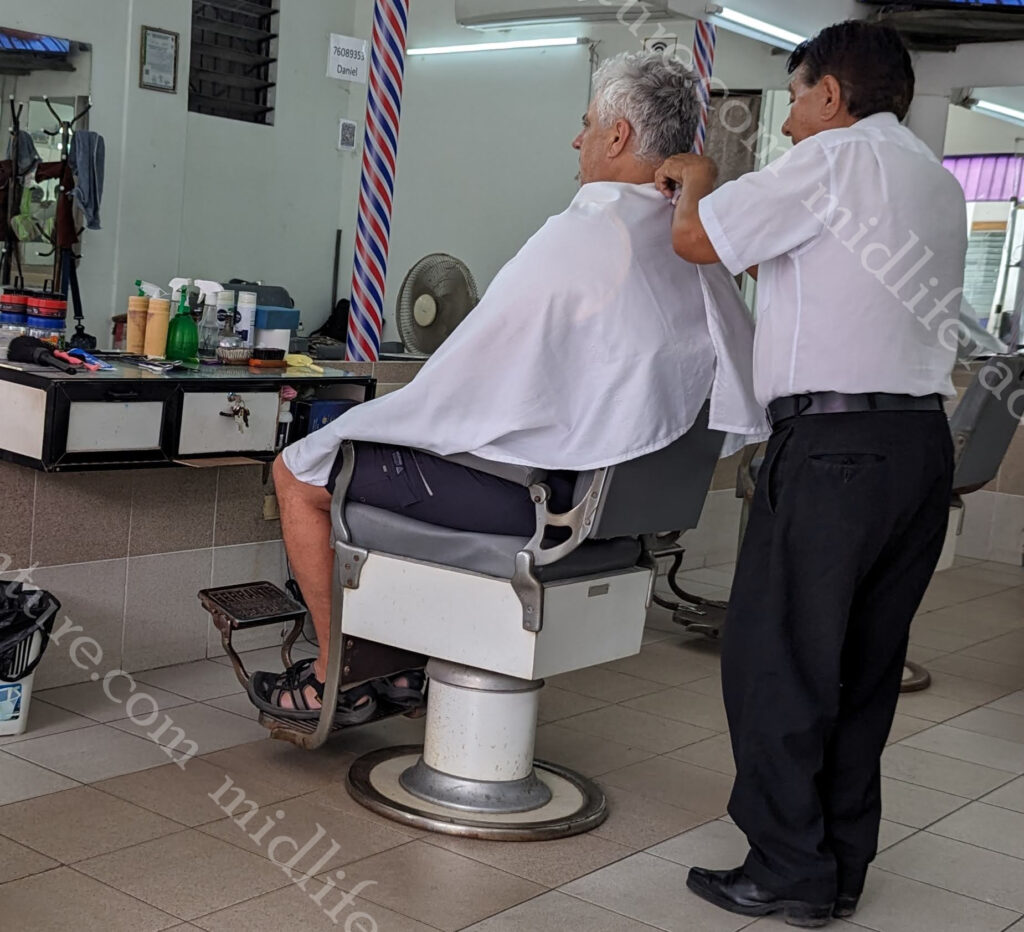
After the park I saw the local barber and decided it had been a while since I had been Manpered.
So I pulled in for a haircut and a straight razor shave.
I still highly recommend these.
Next stop was the main square (the Plaza 24 de Septiembre) which is a large square filled with plants, tall palm trees and benches. Until recently, sloths were hanging from tamarinds’ branches bordering the square. They are now in the zoo. And they had the coolest little old dudes wandering about in yellow offering to sell you a coffee.


The square is dominated at one end by the Cathedral Basilica of St. Lawrence.


The rest of the square is surrounded by government buildings and shops. There is an artisanal alley close by with very cool local handicrafts. Which i would have got some if space was not an issue.


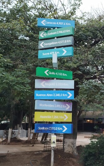
Plaza Calleja is a huge fizzer, billed as the centre of South America.
It is just a tiny park with the centre allegedly marked with a wooden cross and a sign with city names and distances.
If you take a good look at any map it is not really the at the centre of South America.
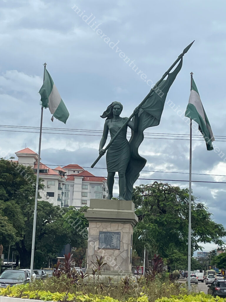
The tourist blurb billed a Christ the Redeemer, similar to Brazil, right here in Santa Cruz de la Sierra.
Needless to say we were underwhelmed when we found it holding up traffic as a roundabout, at a busy intersection, just North of town.
Having blitzed town we opted to take a private tour that cost us about $100 for the driver for the day but involved a 6am pick up and a whole day exploring with a 5:30 pm drop off. So for almost 12 hours of his time and the fuel and guidance $100 (for the two of us) it was a steal.
Samaipata
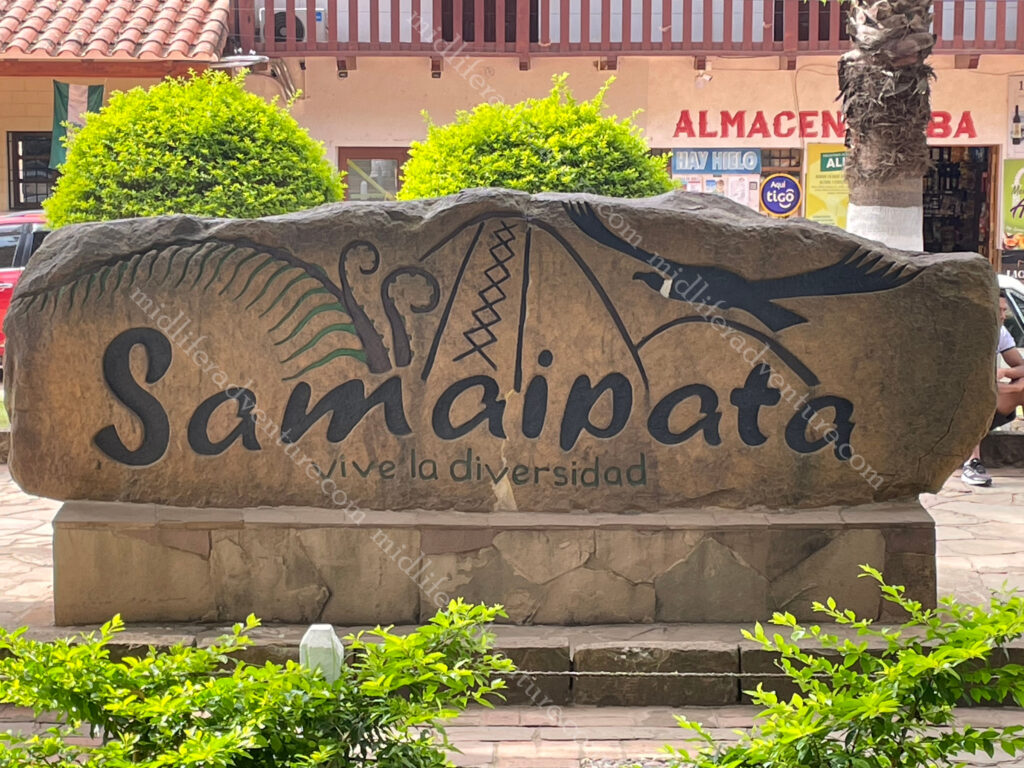
About 120 kilometres (and over 3 hrs driving) to the southwest of Santa Cruz de la Sierra in the foothills of the Andes (still at just under the height of Mount Kosciuszko) is the small town of Samaipata.
The town itself is seriously nice and small with colonial buildings and narrow cobblestone streets. The centre is set around a really nice, and seriously well used park, which seems to be the focal point for all activities in the tiny town (under 5000 people).


But the main reason for coming was to see the El Fuerte de Samaipata or Fort Samaipata. But before we did, a quick pop into the Archaeological Museum (a four room display) for a poke about (one $11 ticket does both) before heading up the mountain to see the main attraction.


But before you get to the site, you are met with some pretty spectacular mountain, farmland and jungle views from the foothills of the Andes.


This is a UNESCO listed pre-Columbian archaeological site. The site encompasses buildings of three different cultures: Chané (pre-Inca), Inca and Spanish. It is believed to have been started by the Chané but there are also ruins of an Inca plaza and residences, from the late 15th and early 16th centuries.


The archaeological site is about 20 hectares (49 acres) and is divided into a ceremonial sector and an administrative/residential sector. The ceremonial sector is a large rock (220 x 60 metres) that has been almost completely covered with carvings of both Inca and pre-Inca origin. At the highest point of the rock you find “coro de los sacerdotes” (choir of the priests) . This is 18 niches carved into the rock, that were believed to be seats.


The residential and administrative sector is believed to have been an Incan provincial capital. It has a large plaza about 100 metres on each side bordered by a “kallanka,” (rectangular building typical of Inca cities). The kallanka is 70 metres long and 16 metres wide and was typically used for public gatherings, feasts, and housing visitors and soldiers. The kallanka at Samaipata is the second largest in Bolivia.


Having milled about taking photos for a few hours we headed back to town for some well-needed lunch and a look around the tourist shops in the rain.


This was a fantastic day that saw us hiking up and down the side of a mountain and checking out some Incan ruins. I did not know it existed before now, but really loved the opportunity to get out and about amongst it.
About 35 minutes from Santa Cruz you can find the Biocenter Güembe Mariposario, which is a combined eco-park and a pool complex. The park is home to the world’s largest butterfly sanctuary and houses a diverse collection of orchids in its “orquideario“. There is an aviary where you can see scarlet macaws, toucans, parrots, peacocks and other colourful tropical birds, along with the odd monkey. Having seen birds, butterflies and not particularly being into pool developments we passed on this, but by all accounts it is ok.
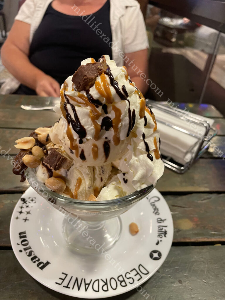
On our middle evening in Bolivia we had a very ordinary meal that we decided to top off across the road with an extraordinary dessert.
It was extremely decadent, totally unnecessary, over the top and was magnificent.
Well Bolivia has been great. This goes on the list of places to come back to to get up high in the mountains to La Paz and Lake Titicaca. We did not make it this time as time was tight and we both knew full well the effects of altitude after our earlier Everest adventure.
The next trip will include the long awaited Machu Picchu in Peru which sits at a similar elevation as Lake Titicaca and Cusco. If you want to play about at decent elevations we found last time around that it is best to spend some time acclimatising. So it may be a nice trip to bounce about at the 3500-4000 meter elevation level for a while doing so.