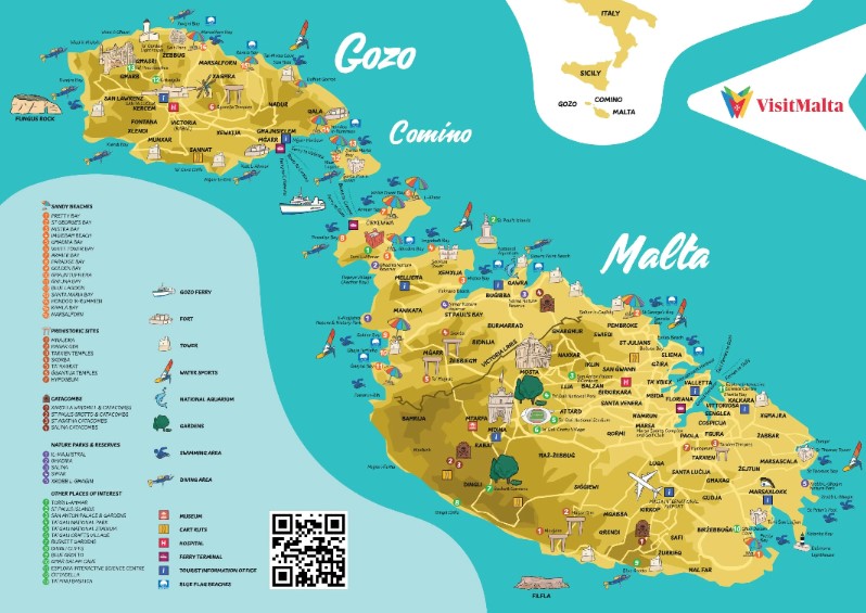
Malta is an island country in the Mediterranean Sea consisting of 3 islands (Gozo, Comino and Malta). It lies 80 km south of Sicily, 284 km east of Tunisia, and 333 km north of Libya.
Malta has been inhabited since around 5900 BC and its prime location in the centre of the Mediterranean and deep harbour has made it a vital area of strategic importance, particularly as a naval base. As such, every man and his dog has had a crack at owning and ruling the islands. The list includes the Phoenicians and Carthaginians, Greeks, Romans, Arabs, Normans, Aragonese, Knights of St. John, French, and British. In 1964 it finally got independence from the UK and became a republic in 1974.
Ok lets get this in perspective right up front, the place is tiny. It has an area of around 320 square kilometers and a population of a bit over half a million. The main island is 27 km long and 14.5 km wide. For perspective the entire nation is a quarter the size of Hobart with double the population.
Getting Around
Getting around Malta is pretty easy, cheap and efficient. The taxis are metered and there are fixed-price options available if you are coming from the airport. Uber and Bolt are competing fiercely to get control over the ride share options and the bus system is extensive, regular, cheap and and efficient.
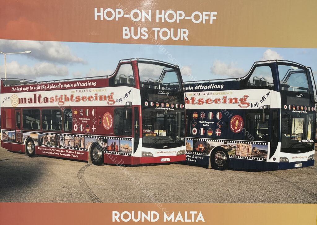
Our option was the HOHO. The Hop On Hop Off bus. We have used these in some locations and they have been magnificent and have inquired in other places and they have been highway robbery. Here in Malta they are magnificent.
The Malta HOHO has a northern and a southern route and there is so much to see that a full day on each is more than warranted. There is also a package that you can do that on day 3 you can include a harbour cruise. We didn’t take the package but did end up doing a harbour cruise because the forts are really best seen from the water.
Yes, you could do it cheaper by local bus, but 20 euros for a full lap of the island, stopping at all the main sights, with an audio guide in about 12 languages is pretty tough to beat. By comparison, the one in Paris is more than double this price and travels a shorter distance and the one in Sydney starts at $50 for a single day.
Day One
After getting in, settling in and finding a (magnificent) feed (our flight had been delayed several hours) after we had missed breakfast and lunch, our first day was pretty much over.
But we did manage to have a lovely walk along the waterfront of Sliema (the Jutty Outy bit above Valetta).
Which has some pretty amazing views over the old city.


So we ate, did our research and crashed for the day ahead.
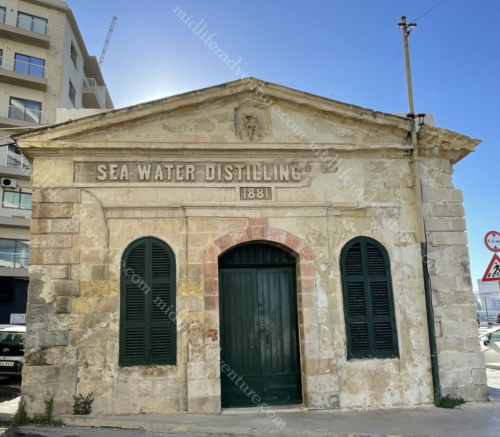
Almost right outside our hotel we came across the Sea Water Distilling Plant. As Malta is an island, access to potable water has always been a problem. This plant was constructed in Sliema in 1881 to provide drinking water for Tigné Barracks.
Today, the building houses a printing press.
Day two saw us getting up early and hopping on the HOHO for the northern route. It took us past the harbour and marina, delivering views of Manaoel Island (one of the many fortifications) on the way until we got to the gates of Valetta. This was the identical route that we would take the next day but tomorrow we got off in Valletta.
Instead we stayed on and made our way through some very funky suburbs and on to the San Anton Palace and Gardens. From 1802 until 1964, San Anton Palace was the official residence of the British Governor and is now the residence of the Maltese President. From here it was on to see the Mosta Dome which is the third largest unsupported dome in the world. It has an outside diameter of 56.2 metres, an inside diameter of 39.6 metres and an internal height of 54.7metres. It became famous during WWII when a bomb pierced the dome, landed and slid across the church floor without exploding! The church was crowded when the bomb hit and all were spared.


The next was the aviation museum and then a few stops were arts and crafts stops (glass factory, craft village etc.) But then the main attraction of the Northern Route, the town of Mdina. The city was founded as Maleth around the 8th century BC by Phoenician settlers. The history of Mdina traces back more than 4000 years. According to tradition it was here that in 60 A.D. that the Apostle St. Paul is said to have lived after being shipwrecked on the Islands.
The city was the capital of Malta throughout the Middle Ages, until the arrival of the 1530.


Directly outside the gates of Mdina is the town of Rabat, although it was once thought to be within the confines of the city. It is home to some impressive catacombs and archaeological remains not to mention some pretty incredible religious bling.


From here there are a few beach and ruin stops and we hopped off for lunch in Bugibba which is a lively seaside town with bars, restaurants, and hotels. Nothing particularly historic here but a lovely little spot. The next stop was the National Aquarium then another beachside town and it follows up with a scenic drive through a series of very pretty seaside bays on the way back.


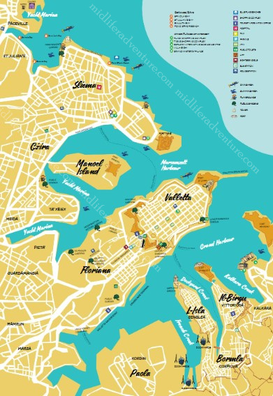
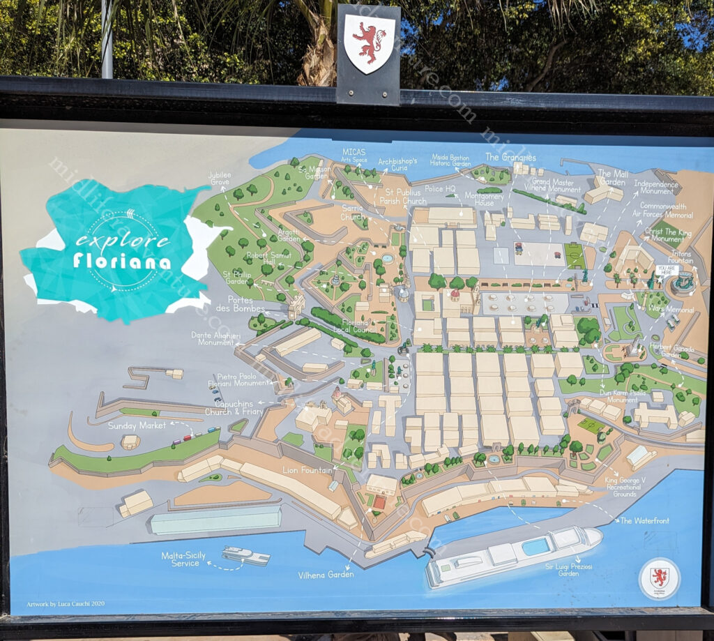
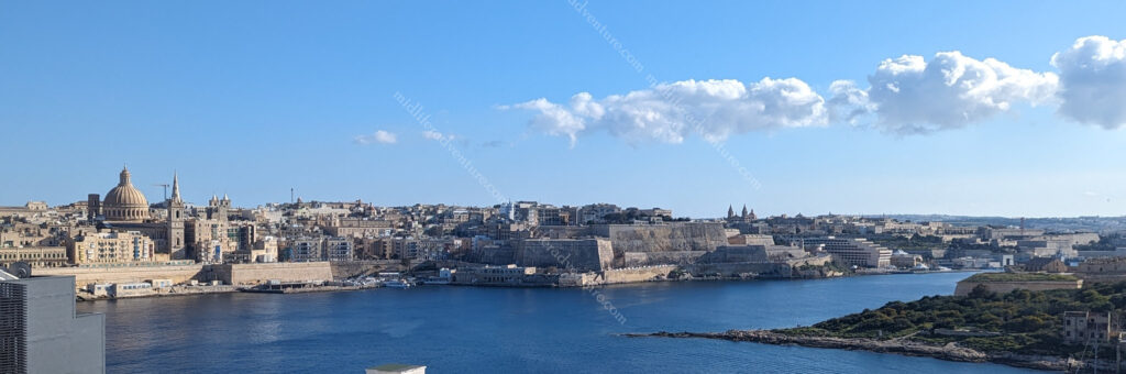
Day three saw us hopping on the HOHO for the southern route. The first stop was of course, the nation’s capital (Valetta), which is less than a square kilometre in size. It occupies the peninsula between Marsamxett Harbour (west) and the Grand Harbour (east) in a suburb known as Floriana. .
It is essentially just an old town CBD, perched on an isthmus. But there is so much in there. UNESCO has described Valetta as ‘one of the most concentrated historic areas in the world‘
When you hop off the bus you find yourself at the Independence monument opposite the Saint Publius Parish Church. The first stone was laid down in 1733 and construction was complete in 1768, when the relic of Saint Publius was brought to the church.


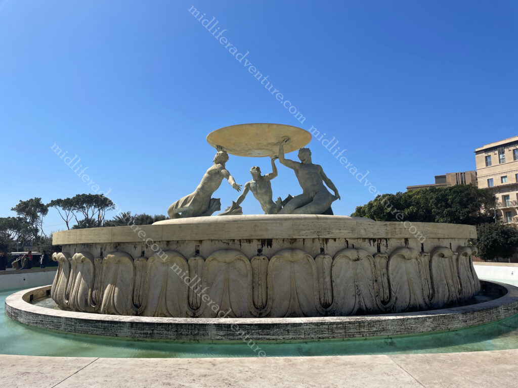
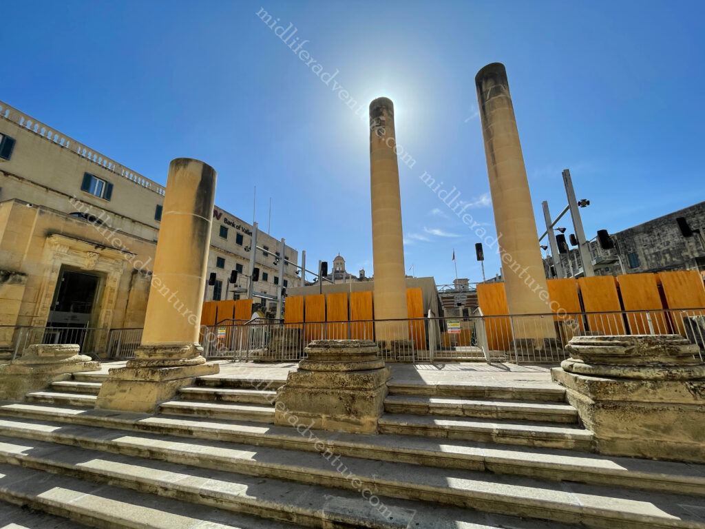
from here a very scenic walk begins towards and through the area that is Valetta. The first thing to signal your arrival is the Triton Fountain.
Triton Fountain consists of three bronze Tritons holding up a large basin. It was built out of concrete and was clad in travertine slabs.
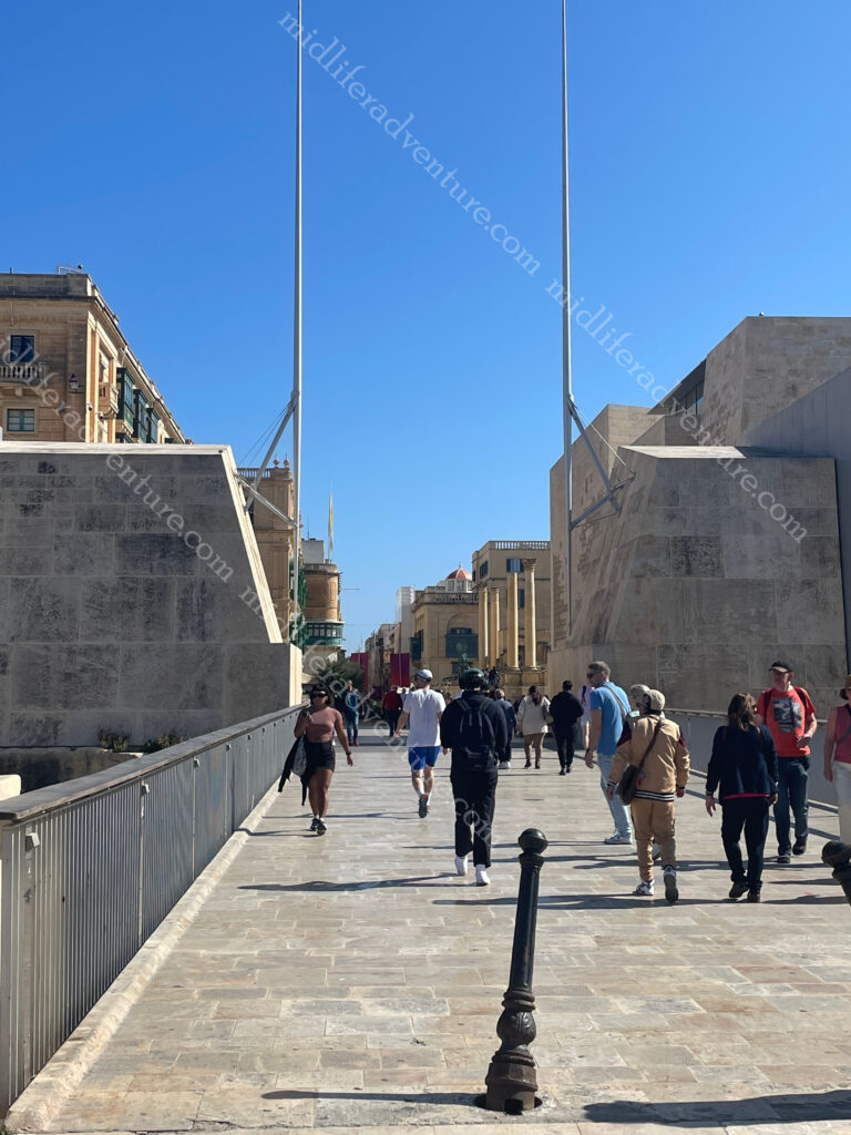
The City Gate was originally built by the Knights of Malta but was destroyed in WWII. It was replaced in the ’60s with a lavish version but people didn’t like it. So there is now a minimalistic bridge.
On either side of the gate is a pole symbolising swords, saluting everyone entering the city.
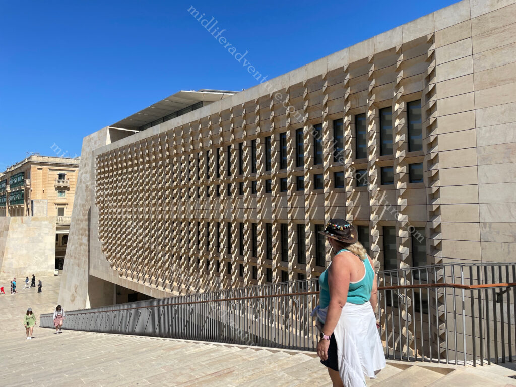
Through the gate on the right you will see the Parliament House of Malta. It was built between 2011 and 2015 on the site of the old railway station .
A bit further down and you run into the Opera House. The theatre received a direct hit from aerial bombing in 1942 during WWII.
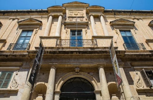
Down one more block and you are at the National Museum of Archaeology.
One more block and you hit the Saint-John’s Cathedral Museum.
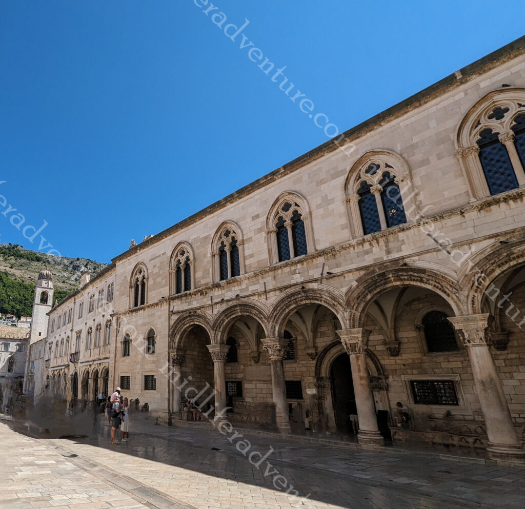
And now you find yourself in St Georges Square which is the central square that is surrounded by a whole heap of stuff. All of this up until this point and all you have had to do was walk in a straight line for 700 meters.


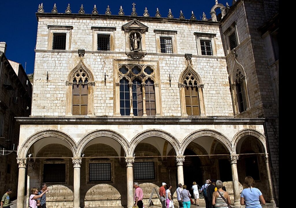
Not least of those to be found in the square is the Grandmaster’s Palace which was Parliament House until the opening of the new one.
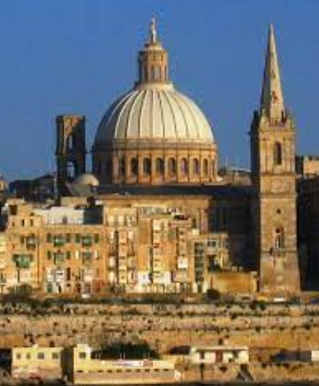
St Pauls Cathedral (Anglican) is the huge spire next to the dome that dominate the skyline of Valetta. Built in the 18th century it occupies prime location in Independence Square.
The dome is the Basilica of Our Lady of Mount Carmel (Roman Catholic). It was originally built in the 16th century but was destroyed in WWII.
Keep walking in a straight line and you hit the end of the isthmus and find yourself at St Elmo Fort. This area also includes a war memorial. A bit further along (coming back to the right) you find another war memorial with the Siege Bell. Then you end up hitting the Upper and Lower Barakka Gardens, these are in essence both more war memorials with plaques and statues celebrating those who paid great service to Malta over the centuries.


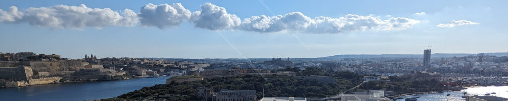
The Upper Barrakka Gardens are located on the top of the Valletta bastions, they offer stunning views of the Three Cities. They were built in the 16th century by the Knights of St John as a private gardens for the Grand Master and the Knights of St John.


Across the Grand Harbour from Valetta sits the Three Cities. Each of the cities have two names that are used interchangeably, the original Maltese name and the newer name given to them by the Knights of Malta.
Birgu – Vittoriosa
Isla – Senglea
Bormla – Conspicua

The first two occupy peninsulas jutting into the Grand Harbour while the third sits behind them (but also has a port area). There is another peninsula that doesn’t seem to make the grade in the cities debate (Kalkara) but it has two major defensive forts in place (Fort Ricasoli and Fort Rinella). In total there have been nine separate forts established just to defend the Grand Harbour.
Birgu (Vittoriosa) is the oldest and was built up by the Knights of Malta as their headquarters when they arrived on Malta in 1530. Senglea (Isla) gives more of a local experience with few formal sights, while Bormla (Conspicua) is set back behind these peninsulas. Also jutting into the harbour is the peninsula of Kalkara, which can be seen from across the marina.
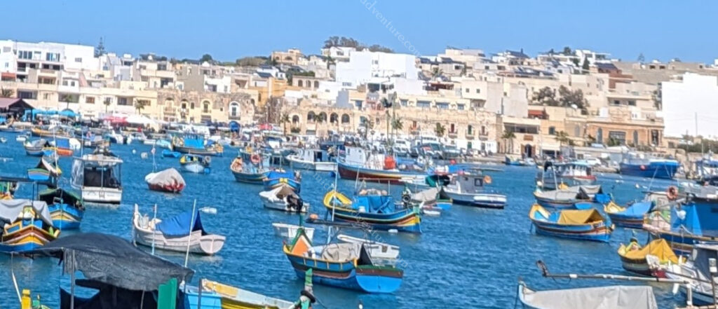
Back on the bus and there was a stop at the Marsaxlokk fishing village which would have been an awesome stop for lunch but we had spent too long exploring Valetta and were pushed for time now.
Next (major) stop was to the Blue Grotto which are a series of sea caverns on the south east coast of Malta. Set against a cliffy terrain near a local fishing harbour the blue grotto and neighboring caves offers spectacular views of rugged coastlines, sea caves opposite a small uninhabited islet (Filfla) which is a bird sanctuary.


Malta has often been called the ‘Fortress Island’ due to the great mass of military architecture that can be seen everywhere. This is a legacy of the islands’ history which saw them being fought over, time and again, due to their strategic location and deep, safe harbours.
So the best way to see these forts built to defend from attacks from the sea, is by boat. Which is exactly what we did. The fortifications that can be seen today come from two distinct periods: those of the Knights and those of the British era. Hopping on at Sliema (our home for the week) we took a 2 hour ride around the harbour takin in most of the 9 forts that were built to defend the harbours.
First on the list was Fort Manoel which sits on its own island between Valetta and Sliema and commands Marsamxett Harbour. The fort is built in the shape of a square, with a pentagonal bastion on each corner, giving it the shape of a star fort. It was built in the 18th century by the Order of Saint John and was named after their Grandmaster of that time. It sits between


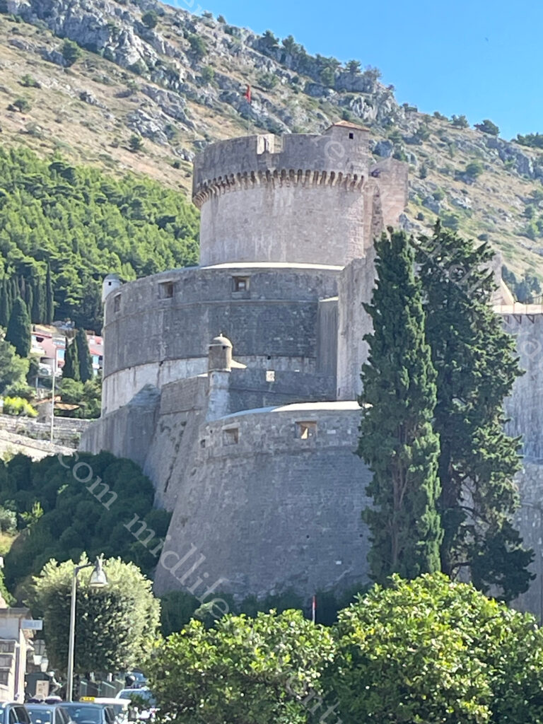
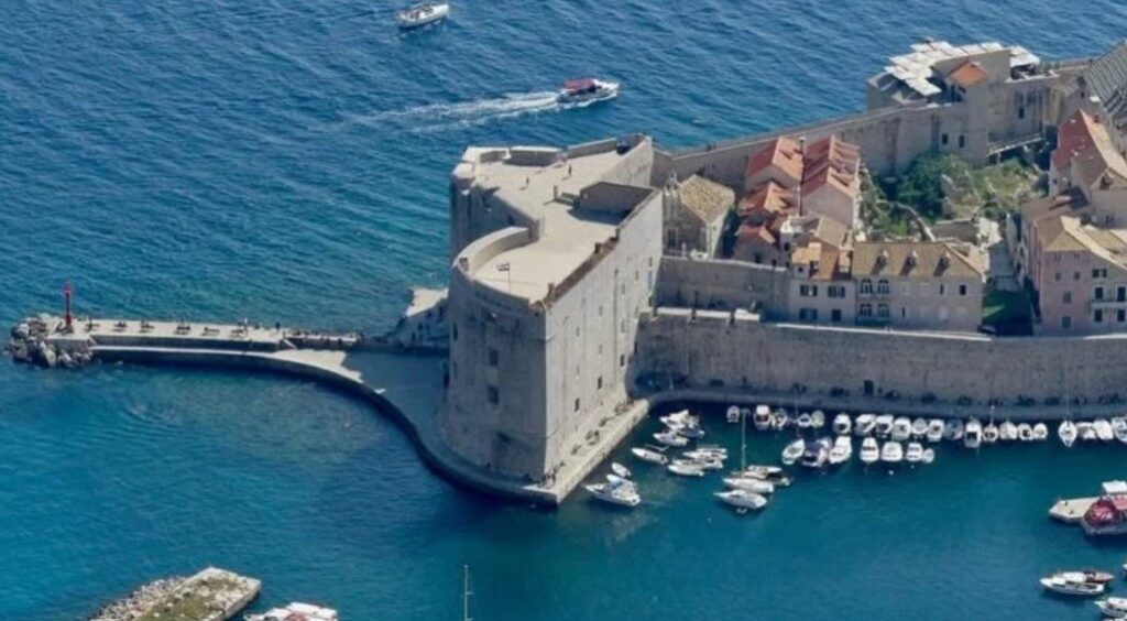
The next in line is Valetta itself with Fort St Elmo guarding the approaches to both Grand and Marsamxett Harbours. We had seen it from the ground the previous day and now we got to see just how imposing it would have been to try and attack this place from the water. It was the scene of a heroic defence during the Great Siege of 1565.


Fort Ricasoli is over 300 years old, being built by the Knights Hospitaller between 1670 and 1698. It is the largest fort in Europe . It was built to protect the Grand Harbour.
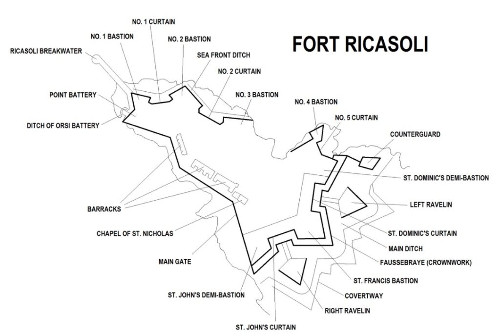
But today most of the fort is leased to the Malta Film Commission. As such it has been used extensively as a location for various films and serials.

In recent years, it has been used for the films Gladiator (2000) and Troy (2004) standing in for Rome and Troy respectively. The fort was also used in the filming of Assassin’s Creed (2016). In addition the TV miniseries Julius Caesar (2002) and Helen of Troy (2003) were partially filmed at the fort and in the first season Game of Thrones it was used as the Red Keep.
Fort St. Angelo is located at the centre of the Grand Harbour. It was originally built in the medieval period as a castle called the Castrum Maris.
It was rebuilt by the Order of Saint John as a fort and named Fort Saint Angelo between the 1530s and the 1560s.
Many believe it to be the jewel in the crown of The Maltese Islands’ military heritage.
The Ħal Saflieni Hypogeum is an underground complex of halls and burial chambers dating to around 4000 B.C. It was in use between 4000 BC and 1500 BC and covers an area of around 500 square metres. This one we didn’t get to as time just evaporated on us here in Malta with so much to see and do. Next time I guess.
Maltese food
I am sure that there is a bunch of traditional Maltese dishes that are floating around out there just waiting to be absorbed, but suffice to say that you are on an island close to Italy, Greece, Turkey and northern Africa. There is so much good food to be had here that you literally can not go wrong. We had plates and platters and pizza’s, soups and rolls. We had rabbit, pork, seafood and we had sweets and savouries.


And it was all fantastic, and reasonably priced.
When we were coming here we had little knowledge of what to expect and therefore our expectations were low. But this place has absolutely blown us away. An abundance of things to see and do, coupled with our ignorance of what we would find meant that we have seriously undercooked how much time we needed. We were here for 5 days, thinking that we could just kick back and relax (given that it was so small) but found ourselves at a full sprint almost the whole time and still missed out on seeing things.
I guess that is the beauty of travel, we will just have to come again and spend more time next time around.