I cannot state clearly enough how much I did not want to come to New York. This has never been something that I wanted to see or go to, but figured as part of this global exploration that I would have to go some day.
Well this was my day (two as it happened) an we only came because it was part of the ship’s itinerary.
I don’t know whether it is possible to be racist against an entire city, but if it is, then I am. I have never been here before and my only knowledge of New York has come from the television and movies. And from these depictions alone I have developed a deep hatred of the city, its people and all it stands for (at least by portrayal). The ‘we are the best’ attitude (in my opinion) is arrogant, misplaced and unwarranted and this rubs me up the wrong way and has done for decades now.
But I have friends who have been and loved the place and speak highly of it. So here we are, in New York City with me trying to take it how I see it and remove the preconceived chip off my shoulder.
Before even arriving we had a win. The original plan was to arrive and land in New Jersey cruise ship port, this would have left us 35 kilometers from NYC and would necessitate a (minimum) 45 minute commute each way. Instead we came right up the Hudson River and ported at Pier 88, a mere 15 minute walk (through Hells Kitchen) to Times Square and the heart of the city.
Arriving by water our entry saw us floating past the Statue of Liberty (at 4:30 in the morning) and Ellis Island (the original US immigration entry point and now museum).
Despite my innate hatred of the place, I must admit to having a level of excitement at the thought of coming in this way and seeing the ‘Chick with a Stick’.
On July 4, 1884 France presented the United States with the Statue of Liberty. It stands 15-storeys tall (without its pedestal). It was shipped across the Atlantic Ocean in crates, and rebuilt in the U.S. as France’s gift to the American people. A couple of days later, on our exit from New York, we would again pass the Statue of Liberty. But this time it would be 4pm and would allow for much better photographs than our grainy nighttime efforts.

Our captain had checked with the port authorities and discovered that the river (Hudson) would be relatively quiet, so he asked for and was granted permission to do some 360’s in front of the statue. On arrival we stopped, put the thrusters on and the ship slowly rotated 3-4 times allowing everyone ample opportunity to get as many photos as they wanted.
Well almost everyone. I had hoped to get a selfie with the statue in the background. As Jill’s phone camera has a better zoom function she went first while I held the table and our seats in the lounge. And for the next 45 minutes I kept holding the table until the ship straightened up and sailed out of the Hudson River, and then Jill returned. I raced out to try and get my selfie but by this stage you could not even tell there was an island there, let alone a statue.
The night time entry and afternoon departure also allowed for some pretty nice photos of the city as we came in and out.


Our ship ported at Pier 88 which was as central a location as we could have hoped for. Our tourist run started with the walk to Times Square. This is one of those things that is highly publicised as a must see, but in reality is just a tourist hellhole. The square itself is much smaller than you imagined and the official writeups have been forced to include most of the surrounding business district (including the theatre district) making it (according to wiki) a bowtie-shaped plaza five blocks long between 42nd and 47th Streets.
It is lit up 24 hours a day and according to the tourist blurb the brash advertisements add to the ambience. It is the site of the annual New Year’s Eve ball drop (which began in 1907) but from my perspective it was an incredibly overrated and underwhelming mess of lights, electronic billboards, touts and rip off merchants.


Our arrival in Times Square was done mainly as it was the launching point for the HOHO bus that we had organised. New York City is large, there is much to see, and our time was limited, so the HOHO was our choice for getting around. It was not cheap, but logistically it was the best option. There are at least 3 and up to 5 companies offering almost identical HOHO experiences, we chose the Big Bus.
It operates 2 routes, the Downtown (red loop) takes in M&M’s World, Bryant Park, Empire State Building / KoreaTown, Flatiron District, Soho, Chinatown / Little Italy, Brooklyn Bridge, Wall Street / Charging Bull, Statue of Liberty / Battery Park, World Trade Center, Chelsea / Pier 57, Hudson Yards, and the Circle Line Sightseeing (the ferry to the statue of liberty).
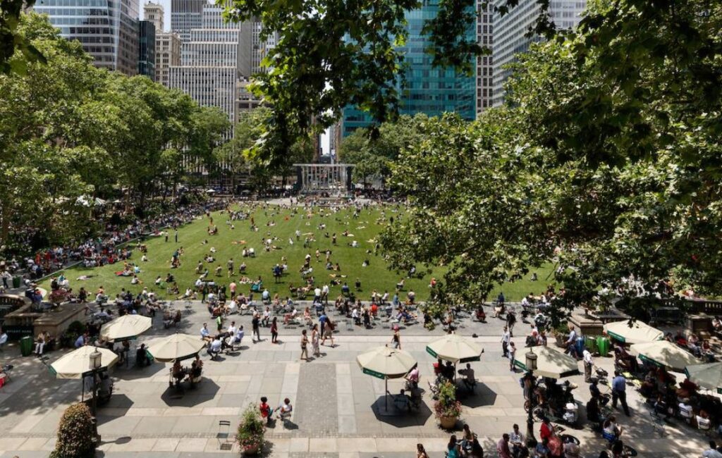
Bryant Park is Midtown Manhattan’s town square, with seasonal gardens, eateries, bars. Apart from being insanely busy at all times it looked really nice.
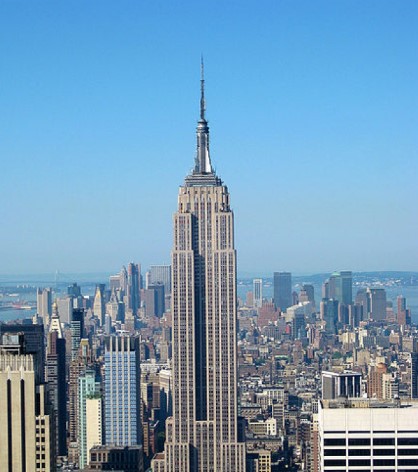
The Empire State Building is the next stop and has consistently been rated as number one on the list of Top Attractions in the World.
There is an observatory deck on levels 86 ($44) and 102 ($79) both of which attract an additional $5 booking fee.
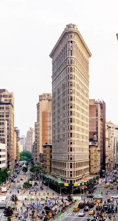
The Flatiron District is named after the famous triangular Flatiron building.
This was (of course) covered in scaffolding when we came past.
Soho was next which is the obscenely expensive shopping district (we stayed on the bus).
Chinatown and little Italy were next and this was our lunch stop (on the second loop around). Grotty streets full of African immigrants selling stolen and knock off gear from sheets on the ground (very reminiscent of Europe).
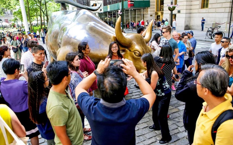
Brooklyn Bridge was next, closely followed by the financial district and the famous Wall Street Bull (great photos to be had here).
Statue of Liberty / Battery Park we skipped and hopped off at the World Trade Center and the 911 memorial. Being a Tuesday the museum was closed but the area is nice and was well worth the visit. The memorial has been done in a simple and understated manner and was very good.


The last stops were the Chelsea / Pier 57, Hudson Yards (old rail yards and residential development), and the Circle Line Sightseeing (ferry to the Statue of Liberty). We skipped these but did take note of the extensive pier redevelopment that was taking place along the Hudson River. The river was dotted with Piers (we were parked in Pier 88) many of which were long past their use by date. Being a big city with limited green space, the authorities have been redeveloping old piers to add recreational areas to the city.


The Uptown (blue loop) crosses path with the red loop at Bryant Park and takes in Hope Sculpture, Midtown East, The Metropolitan Museum of Art, Central Park Zoo, Columbus Circle and Carnegie Hall (covered in scaffolding). Our main purpose of the uptown loop was that we had booked tickets to the American Museum of Natural History.


Central Park is an 840 acre park in the middle of Manhattan that extends about 4km long (between 59th and 110th streets) and 800 meters wide (between Fifth and Eighth avenues).
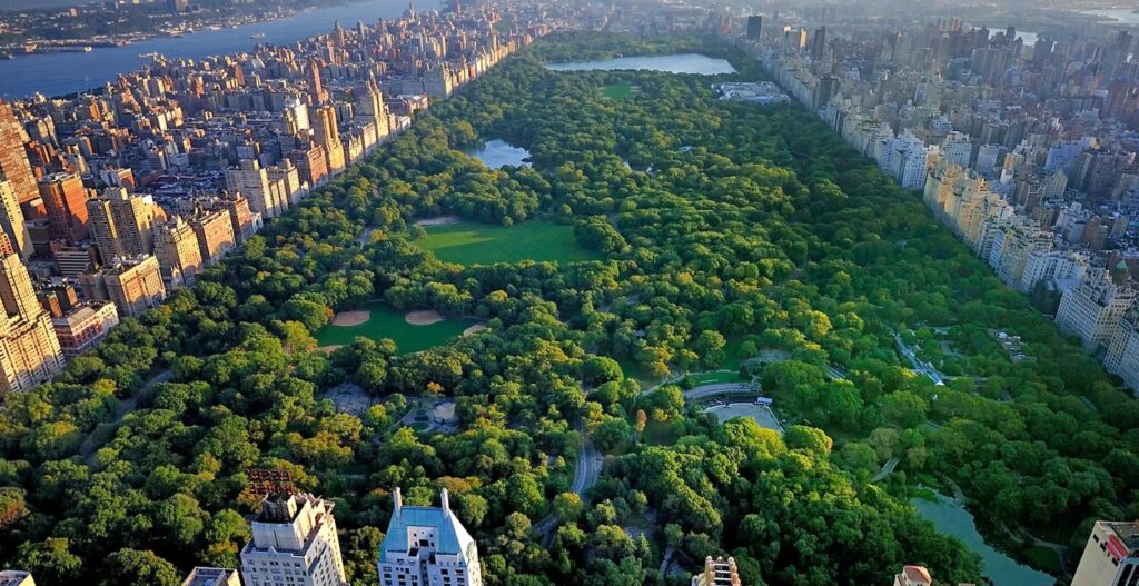
It is divided for convenience into four “quadrants” (from south to north). The southern end is dominated by the zoo, the second section is named the great lawn, for pretty obvious reasons. The third section is around mid way with the Metropolitan Museum of Art and the Natural History Museum on each side of the park then the Reservoir (a 106 acre pond).


According to wiki the park was fully landscaped when built in the 1850s and 1860s. It has eight lakes and ponds that were created artificially by damming natural seeps and flows. There are several wooded sections, lawns, meadows, and minor grassy areas. There are 21 children’s playgrounds and almost 10 km) of drives. It is also one of the most filmed locations in the world.
Day one over, we got changed and headed back out for night one. It has been written up everywhere that you cant go to New York without seeing a show on Broadway. This to me was one of those arrogant things where they think that everything here is the best. But we were here overnight, so why not. On recommendation from my mate Jimmy we bought tickets to the Book of Mormon.
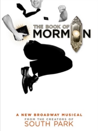
It is a musical comedy from the creators of South Park. The story follows two Mormon missionaries as they attempt to preach to the inhabitants of a remote village in Uganda.
Needless to say the locals are more interested in dealing with HIV/AIDS, famine, female genital mutilation, child molestation, and oppression by the local warlord.
The show itself was hilarious, poking fun at (almost all) organised religion in a highly inappropriate manner. There were times when I has tears running down my cheeks from laughter. The experience on Broadway itself was not as pleasant. Our night started with being inundated with passive cannabis smoke, smelling uncollected rubbish and urine, while watching two homeless men fighting (full on punches and stick style weapons) 10 meters from the theatre door. Thankfully there was no guns but all of this unfolded directly in front of us.
Right next door to our pier (88) at Pier 86 is the Intrepid Museum, this is a WWII aircraft carrier (the Intrepid) that is stacked with a bunch of military stuff, right in the heart of the city. The Intrepid was launched in 1943 and survived five kamikaze attacks, and one torpedo strike during WWII. The ship later served in the Cold War, the Vietnam War and as a NASA recovery vessel.
The flight deck of the carrier has dozens of military aircraft including fighter jets, a supersonic spy plane, the Concorde and many helicopters, while its halls host much more. Some of the things you can see are the Enterprise (first space shuttle), Growler (the only nuclear-weapons-carrying submarine open to the public). For my mate Mike who is a plane and military nut I have included the link to the full aircraft guide of what is there and the various specifications of each of the planes ( https://live-intrepid-museum.pantheonsite.io/media/aircraft-guide.pdf ). Being right next door, and a taller ship, we got a fantastic view of the aircraft on deck and many people made the trek inside.


The next morning it was up and on the road again. There were a few domestic things that we needed to sort and then it was off exploring again. Thankfully the HOHO bus saved our legs (we had done over 20,000 steps the day before even with the bus).


Given the tight timeline of the day before we hopped back on the red loop (Downtown) for another run (there was just too much to see on a single day). We were not up and out quite as early as the day before so we got hit with considerably worse traffic. But we did get to do all of the New York City iconic sights.


A bit like the pier redevelopment, New York is now home to the High Line. The High Line operated between 1934 and 1980 as a freight railway where it carried meat to the Meatpacking District, agricultural goods to the factories and warehouses and mail to the Post Office. After falling into disrepair it was salvaged by residents and in 2009 sections of the elevated freight rail line above the streets of Manhattan were taken over and turned into a public park.


It was saved from demolition by neighborhood residents and the City of New York. It now serves as a hybrid public space where visitors can experience nature, art, and design.
Our trip out of town was as described earlier, with the 360 degree turns in front of the statue of liberty. I had dreaded the trip to New York, but actually quite enjoyed it (for the most part). Decades of movie and TV watching has made the place weirdly familiar. It was not as horrible as I had dreaded, neither was it as big or as tall as I expected, the sights I had imagined as huge were actually just normal.
- So do I still hate New York City? Probably not.
- Did it live up to the hype? Definitely not.
- Is it as big as I expected? No
- Are the skyscrapers overwhelming? No
- Was I disappointed? A little.
- Will I come back? Probably not.
But my overwhelming memories of New York will be the smell. The entire place reeks of weed, piss and garbage.